Spaces, Territories, Landscapes, and Places
These concepts, extremely linked, structure the processes and social phenomena existing in the human habitat. Over time, disciplines like architecture, geography, anthropology have expressed their own definitions, which leads us today to propose a global interdisciplinary definition.
What is space and how do we inhabit it?
We can define space as hierarchal systems structured and defined by territories and landscapes. We live in the first and we observe the second.
A territory is structured by sequences of places connected between them. These last ones are the result of a spatial appropriation expressed by and individual in their private and public spheres. A place is constructed from natural and artificial forms. It welcomes organizes and models human actions. Places and human actions are fundamentally reciprocal, which is to say that a place is the result of a human act, and a human act the result of a place.
How can we identify the frontiers between a territory and a landscape?
An individual will have their own interpretation of their own distinct reality. This is the result of their experience and their knowledge of the world. Their perceptions of territory will depend principally on the limits of their geographic appropriation.
The transformation of a countryside in a territory arises when we appropriate it physically and or through our sense, by widening the limits of perception. Phenomena, like rising sea levels, wholly transform the physical characteristics of places and the behavior of each individual. In other words, spatial systems will modify our classical perception of space and in doing so, the ways that we construct our societies.
The next part of this article seeks to understand how architecture can respond to the needs of our global situation, in particular vis-à-vis the climate crisis. The different points analyzed will revolve around rising sea levels and reduction of habitable space. These climatic variations, appear as key elements in contemporary architectural and urban construction.
Insular Vulnerability
According to a report published in October 2018 by the IPCC1, sea levels will rise between 26cm and 77cm between now and the year 2100 if the rise in global temperatures is +1.5 °C, an average of 1cm each year.
Consequently, among the affected zones by imminent flooding are Asia and Oceania. In the central and western Pacific Ocean, there exist about 25000 islands, and the average height of the low-lying islands is 5 meters above sea level.
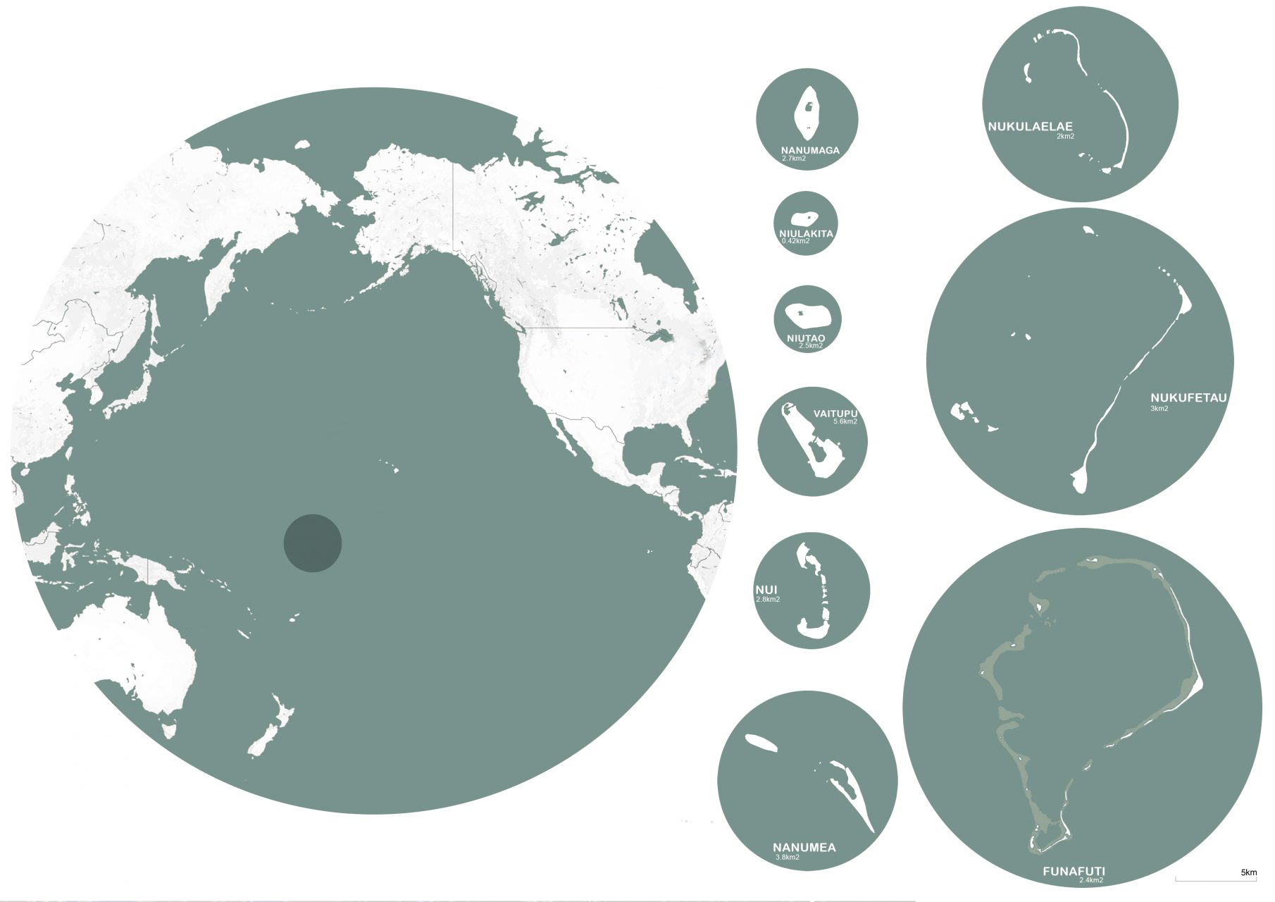
The insular island nation of Tuvalu is an emblematic example of the consequences of global warming. The low elevation and reduced surface area make the country very vulnerable to the rising sea levels. The consequences are already felt on multiple levels. This creates a problem for the disappearance of existing social spaces on the islands, and the possible gradual disappearance of protected cultural heritage sites and traditional practices.
Tuvalu is a typical Polynesian archipelago, which consists of nine coral atolls, and is a former British colony; it became an independent state in 1978. It is situated to North-East of Fiji with a population of 12,177 inhabitants who live on 26 square kilometers. The average altitudes is 1.5 meters above sea level. The capital is located on the island of Fongafale, and is part of the Funafuti atoll2.
As a consequence of rising sea levels, there exist two types of diminutions of the available landmass. The first is temporary, caused by flooding and water ingress. The second is permanent cause by costal flooding.
On the architectural level, it’s the city centers that are most effected by temporary flooding. The housing there provides a very poor quality of life in terms of comfortable spaces. When residential areas are flooded, changes occur in the social fabric, notably an inability to access the main roads the isolation of homes and their inhabitants.
On the urban level, there exists a temporary diminution of the habitable surface. Flooded roads and public spaces confronted with functional changes. On one hand, we can observe a permanent and progressive decline in costal and humid zones with the disappearance of different plant species that protect the islands from erosion. The landscape is thus gradually modified, which also reconfigures the city.
In this context, we explore these questions in two phases, the first on a larger urban scale, and the second on an architectural scale. Each of these explorations involve research on the spatial organization of Tuvaluans faced with increasing amounts of water on their island. Which is to say, that spatial production methods can be considered as a vernacular adaption in response to modifications in their environment.
Territorial Morphologies
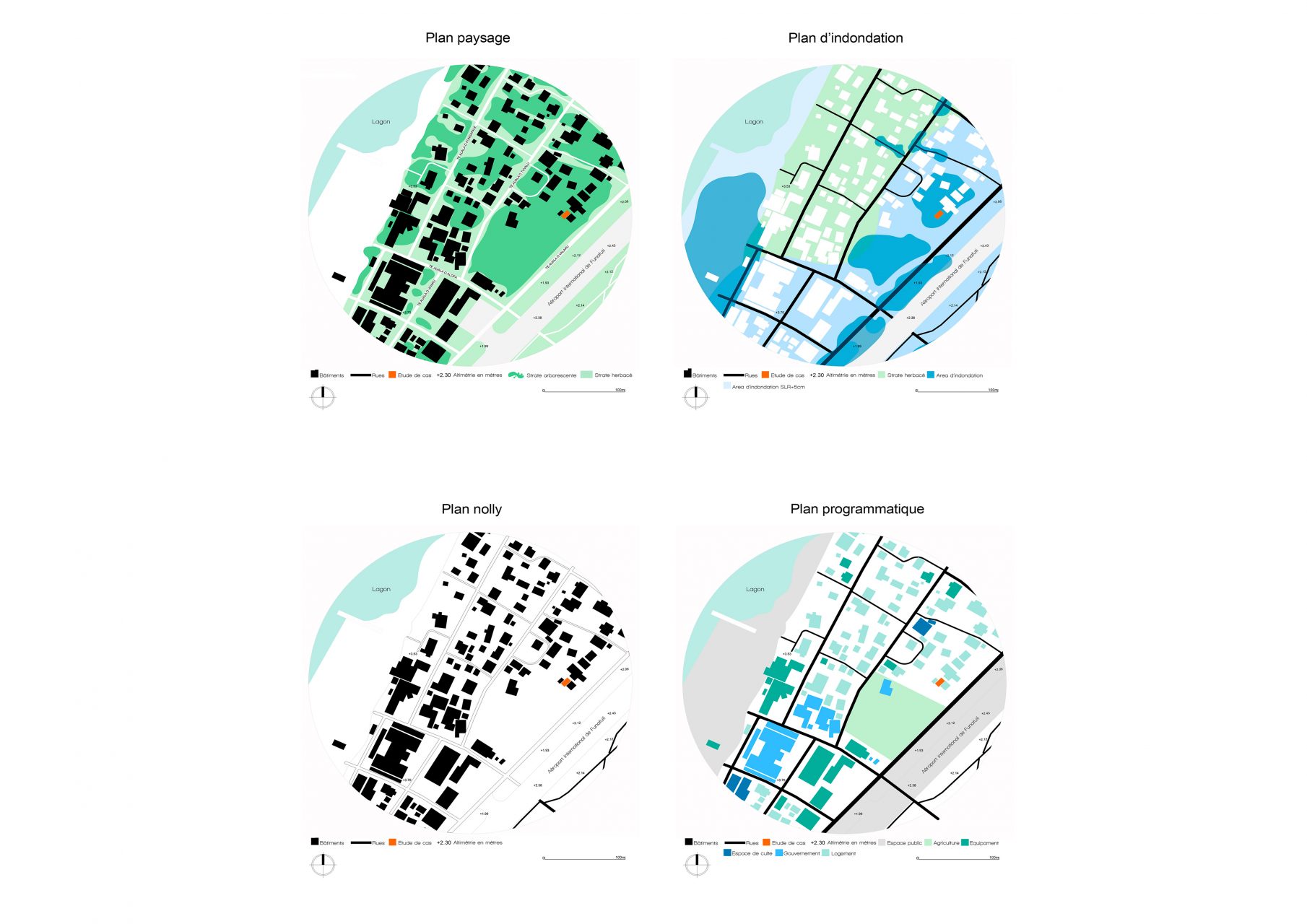
The different landforms that make up Fongafale Island are the result of a complex natural process, which is both variable and cyclic. The anthropogenic processes, like the urban development, both above and below ground, model the landmass as part of a dynamic resulting in loss of space. Today, both the natural cycles and anthropogenic cycles are increasing in intensity, resulting in the flexibility of territorial boundaries and the deformation of the actual landmass.
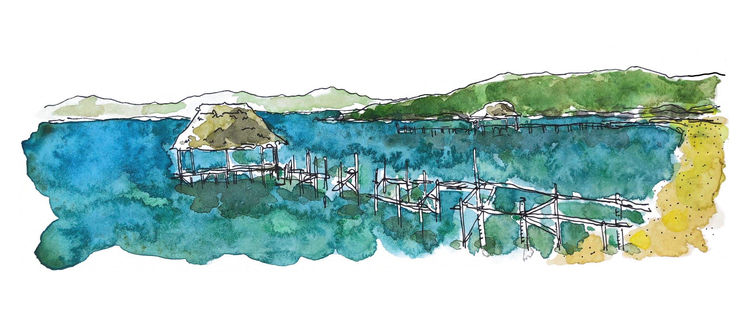
Fongafale has two spatial boundaries to the South and North where the Pacific Ocean flows into the central lagoon Te Namo. Various aquatic equipment allows for a certain flexibility in city limits, which is also a sign that the use and connectivity of these places will progressively adapt.
The constantly changing shoreline is a natural feature on the Funafuti atoll. The beaches allow to respond to the most subtle changes of climatic seasons (light changes in the speed and direction of the wind) and to stronger changes like hurricanes and thunderstorms. Eastern winds will blow larger portion of the sand on the coast towards the outer edges of the island. Western storms will particularly affect these islands, attacking the coastlines that are normally protected from prevailing winds.
As part of an ongoing scientific study directed by the South Pacific Applied Geoscience Commission (SOPAC), satellite photographs from 1984 and 2006 are superimposed on another, and I’ve also integrated images from the year 2017 and 20223. This study allows us to confirm changes in of two small islands in Funafuti: Paava and Fualifeke. These changes are due to costal erosions, which is itself caused by the rise in ocean current that displaces the island’s sand, principally towards the islands’ South-East.
Submersion, Mutation and Hybridity
In Fongafale, there exist various kinds of zones affected by flooding. However, we would like to concentrate on the spaces where there are high levels of human activity, like traffic between homes and primary services, recreational activities, or public spaces in order to permit an analysis of changes linked to this phenomenon.
If there’s a space in a system structured by elements like scale, proportions, shape or material in a constructed atmosphere of a spatial perception, then it seems pertinent to analyze the human components at the moment where one or several of these elements are adapted to new uses.
We can observe the modification of the uses of public space due to the presence of water. It’s the case for the international airport in Fongafale, where the airplane landing strip is dynamically evolving towards bifunctionality.
Today, the inhabitants of Fongafale use the landing strip as public meeting space, which when not use for take-offs and landings, is segmented in different parts. There are many kinds of recreational activities that also serve tribes who come from other atolls in Tuvalu. These so-called hybrid activities continue despite the presence of water.
The main roads are still used just as much, but their used has been adapted to the presence of water. The same goes for houses, which have been adapted to meet rising water levels.
Globally, the spatial structure of public spaces is affected by water and adapts in a hybrid manner. The activities can be modified, but they remain in use.
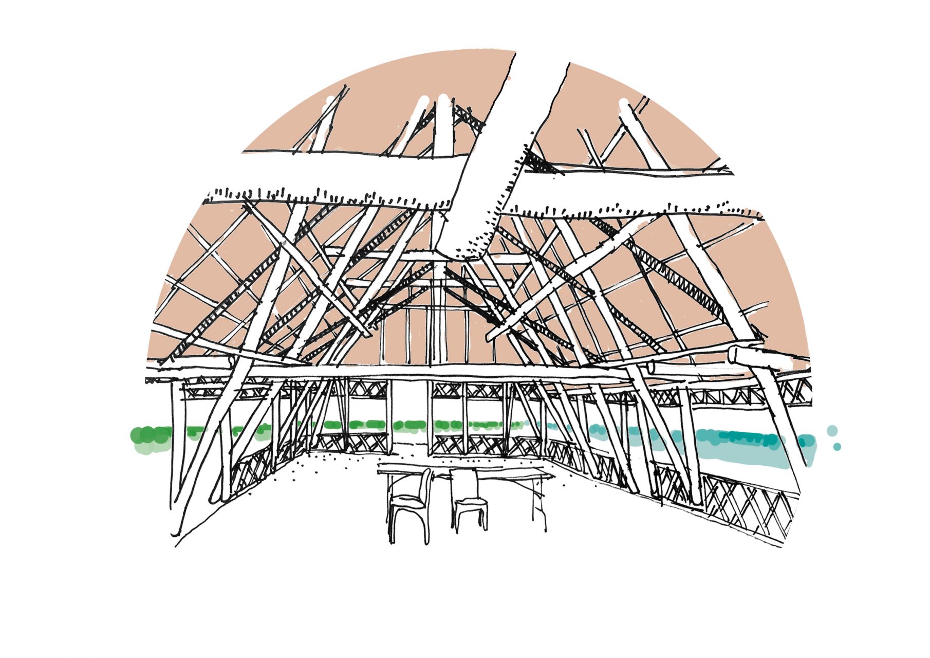
From an architectural point of view, there is a transformation of vernacular construction in its form, aesthetic, and functional. These mutations are linked to flooding. The places that experience changes in morphology are the result of 20 years of evolution that continues to accompany architectural construction, which has always been linked to the landscape.
The evolution of architectural space in Tuvalu was shaped by a relationship to “water-place”. Since the first architectural constructions all the way up until today, local construction has undergone mutations in its spatial structure, but without undergoing profound changes.
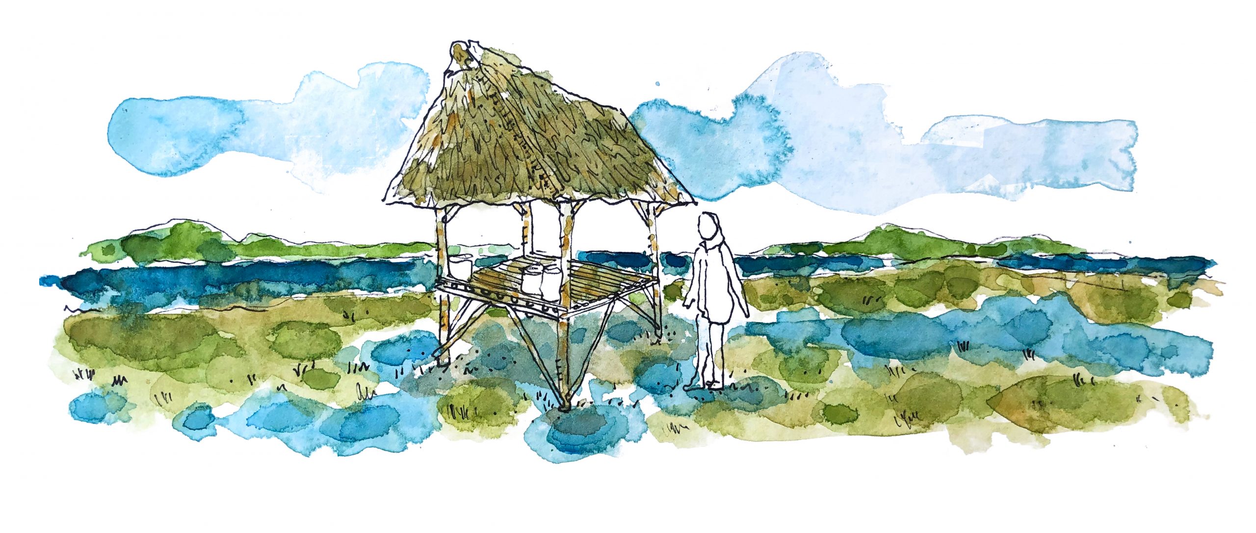
The identity of the private spatial system is characterized by an architectural fragmentation and exteriorization. The spaces that constitute this architecture off a more ample use of space. Different meeting places – for eating, cooking, sleeping, resting – are dispersed. They remain connected visually and spatially with the nearby landscape.
In the 1950s, with the appearance of the first flooding and the arrival of new construction materials, the construction of architectural space in Tuvalu began to undergo transformations.
First all, the fragmented and dispersed spaces are unified and compacted. They create a new architectural typology. The only space that remains independent is the architectural unit for eating and resting (fale umu).
With the rise in flooding, the inhabitants constructed their homes on larger and larger stilts. Many homes lack a ground floor. This transformation generated the superposition of spatial structures and the rise in height of the urban landscape. The resting place, fale umu, which was still independent of the principal building will be attached to the main structure and then placed on the ground floor.
The evolution of architectural space in Tuvalu can be conceptually resumed in three architectural typologies: fragmentation, unification, and superposition. This evolution depends heavily on the increased groundwater in Tuvalu. Even if the places have change shape and position, the spatial continuity of vernacular architecture has been maintained. It’s the most important characteristic of this evolution.
The relationship between territory and landscape was modified because of the presence of water in certain areas in Funafuti. There exists and functional adaptability in the flooded zones, which I have designated as hybrid. This hybrid usage is born out of two spatial heterogenous structures: dry surfaces and flooded surface located in the same place.
If we consider that the aquatic countryside has a visual identity that we identify through a reading as an observer and that the island territory is a spatial identity that we can identify from an existing reading of habitat, we can suppose that in Fongafale the local population lives in the water according to hybrid uses. There exists an inversion between perception of the landscape and territory: landscape is inhabited and the territory is observed.
Conclusions and Scenarios
In the purely architectural domain, the mutations identified in vernacular space are carried out in in morphological, typological, functional, and aesthetic dimensions. The habitable spaces have undergone an accelerated transformation in the last 20 years. This study shows that if the form changes, the fundamental relationship between habitat and territory persist in the extended the arc of Tuvaluan civilization.
According to our analyses, we can distinguish three kinds of evolutions in anthropogenic Tuvaluan spaces: fragmentation, unification, and superposition. These modes are the result of physical and cultural metamorphoses. In physical territories in constant evolution populations try to preserve through sheer will the continuity of traditional representations and uses.
For example, the superposition and the subsequent increased elevation of the fale umu on the ground floor. This produces a dematerialization of domestic spaces on the ground. A radical mutation of the physical limits is perceived; however, collective and family practices do not disappear with the metamorphosis of these spaces. These new configuration of and distributions of built space allow for new range of urban relations, beginning in a radical exteriorization of domestic and private family activities.
In the urban realm, the increasingly recurrent presence of aquatic conditions, substantially modifies both the materiel consistence of the land, its formal and topographic limits, but also the characteristics of villages clusters. This climatic construction and environmental metamorphosis collide with the resilience and longevity of traditional and collective village customs.
The continual process of raising the city up on stilts produces a progressive and generalized liberation of the ground floors in the whole neighborhood. This de-solidification of buildings affects the whole city, in relation to natural soils that have been drastically overwhelmed by urban consistency and representation. The emergence of considerably new urban spaces that agglomerate and regroup the entirety of first floors occupied by the different buildings and putting them in relation in a powerfully new manner. Consequently, public space is transformed as the linear trajectory of roads, full and empty spaces, takes on the consistence of layers that reestablish a visual and physical historic continuity.
Like the anthropogenic islands at the beginning of the 2Oth Century, the public urban space embraces a territorial totality, and the human eye can once again make its way from sea to sea above the city. The spatial horizontality in places allows for collective interactions that are no longer channeled between buildings, as before, but in a newly found continuity on the roofs of these buildings.
By rendering these private spheres public, a unitary relationship between the territory contributes the entirety of daily activities and populations is reconstituted, whether it be public or private. In this context, we will take part in the emergence of new visions and perceptions of urban space.
It seems to me that we can locate the heart of this hybridization process here, in the public fusion of private spheres that are no longer hermetically separated, but are conceived together as part of spatial mutations. It’s in this context of accelerated mutation that the geo-climatic substrate presents itself as an agitator and a simulator of architectural reconfigurations that are homothetically accelerated.
On one hand, the civilizational substrate ensures – at least for the moment – paradoxical forms of continuity, which have in the past devolved into geologic formations.
Eventually, what will the impact of the continuity of these public and private spaces on interior and exterior courtyards?
Will we witness a quasi-inversion, or rather a dissolution of intimate and public sphere, thereby returning towards what we believe to know of ancestral customs, inventing, along the way, an insular retroactive urbanity?
Either way, the perspectives that seem to emerge from the architectural construction in Tuvalu are by nature resolutely hybrid, given race to forced adaptation already underway, generated by the acceleration of climate change, and more precisely, by the apparently inevitable submersion of the Funafuti Island underwater.,
These are the pragmatic and aggregate mechanisms, which remain forcibly impure as they are dominated by survival imperatives, by capitalizing on any available resources, that this study has begun the work of indexing and analyzing. The circumstantial responses are inscribed in short-term temporalities and will logically institute new regiments and mutant spatial frameworks, which in all likelihood fall into three categories.
The first could be developed on site by the establishment of megaprojects on the islands, which through their systematic consolidations could set off massive processes of artificialization, condemning the islands’ current landscapes to the realm of memory.
The second, off-site, could be paradoxically anthropogenically less destructive. Tuvaluan culture is protected internationally and could find a home through migration in other regions that are roughly equivalent to the now definitively submerged Funafuti.
And the third, would be an ocean-culture and an anthropogenic acceleration of the growth of coral reefs.
References
1. Special Report on Global Warming of 1.5°C, IPCC, United Nations, 2018.
2. Division centrale des statistiques, Ministère des Finances, Planification économique et industries, Private Bag, Vaiaku, Funafuti.
3. SOPAC project report 54, Reducing vulnerability of pacific acp states, Tuvalu technical report coastal change analysis using multi-temporal image comparisons, Funafuti, April 2006.
Bibliography
• IPCC, Climate Change 2022: Impacts, Adaptation and Vulnerability, United Nations, 2022.
• Faaniu, Simati, and Hugh Laracy. Tuvalu: a history. University of the South Pacific; Suva Fiji, 1983.
• Koch Gerd, The material of Tuvalu, Institute of Pacific Studies, University of the South Pacific, Suva, Fiji, 1961.
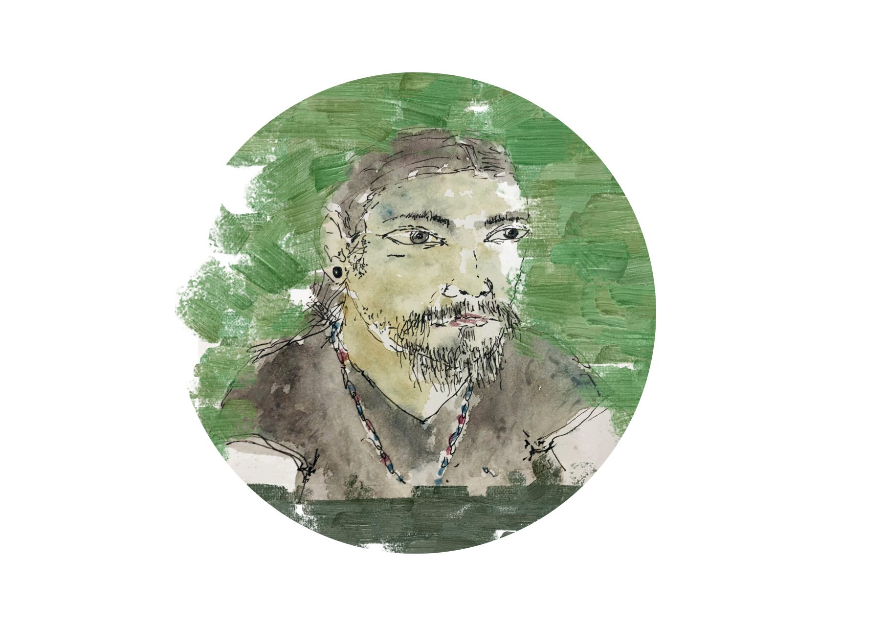
Fabian Gutiérrez obtained a Masters degree at the École nationale supérieure d’architecture Paris-La Villette in 2010. He is a Doctor in Architecture at the Institut Parisien de Recherche Architecture Urbanistique Société. His research interests focus on architectural theories and practices around South America, Oceania and Europe.
He specializes in vernacular and traditional space production as well as more contemporary projects. His PhD dissertation is based on a connexion between these two modes of architectural production in land surface areas affected by the increase of sea levels due to climate change.